
Iyeltak:European political map (chopped).png

Lum ke bata abdiwira : 616 × 600 px. Ar goraks: 247 × 240 px | 493 × 480 px | 942 × 917 px.
Xantaf iyeltak (942 × 917 pixel, iyeltakaldo : 40 kio, MIME ord : image/png)
Pimtara
| Pimtara |
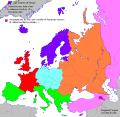
English: see also Image:europe_political_map.png for broader version covering more of Africa, Asia, etc.
|
||||||||
| Evla | Transféré de en.wikipedia à Commons par Shizhao. | ||||||||
| Klita |
Original téléversé par Alinor sur Wikipédia anglais.; La page de description originale était political map (chopped).png ici. Tous les noms d'utilisateur qui suivent se rapportent à en.wikipedia. |
||||||||
| Askisik | Alinor sur Wikipédia anglais | ||||||||
| Novera (Va bata ewava gin faver) |
|
||||||||
| Autres versions |
 |

.png)
Iyeltakizvot
Witison va iyeltak inde in banugale awir, va evla/bartiv vulegal !!
.png&dir=prev)
.png&offset=20080408212011)
.png&offset=&limit=20)
.png&offset=&limit=50)
.png&offset=&limit=100)
.png&offset=&limit=250)
.png&offset=&limit=500)
| Evla/Bartiv | Aluk | Lumeem | Favesik | Sebuks | |
|---|---|---|---|---|---|
| ref | 12 anyusteaksat 2022 à 16:49 | | 942 × 917 (40 kio) | Рагин1987 | Correction |
| 12 anyusteaksat 2022 à 16:31 |  | 942 × 917 (39 kio) | Рагин1987 | More correct visualization of the dividing line on the territory of the Caucasus Range | |
| 15 toleaksat 2012 à 16:57 |  | 942 × 917 (64 kio) | Carnby | Better English captions | |
| 25 alubeaksat 2008 à 13:13 |  | 942 × 917 (153 kio) | Cecil | Reverted to version as of 11:10, 9 April 2008 is that a joke? waiting until the protection is over and than restarting the editwar? | |
| 25 alubeaksat 2008 à 09:39 |  | 942 × 917 (79 kio) | Olahus | ||
| 20 alubeaksat 2008 à 23:12 |  | 942 × 917 (153 kio) | MaCRoEco | Reverted to version as of 11:10, 9 April 2008 | |
| 20 alubeaksat 2008 à 20:56 |  | 942 × 917 (79 kio) | Olahus | ||
| 9 balemeaksat 2008 à 11:10 |  | 942 × 917 (153 kio) | Cecil | Reverted to version as of 20:14, 25 February 2008; situation before edit war | |
| 9 balemeaksat 2008 à 10:06 |  | 942 × 917 (79 kio) | Olahus | Reverted to version as of 10:40, 18 March 2008 | |
| 8 balemeaksat 2008 à 21:20 |  | 942 × 917 (153 kio) | MaCRoEco | Reverted to version as of 15:22, 15 March 2008 |
Favera va iyeltak
Valevefa 6 bugluyaxa va bat iyeltak :
Jadifa iyeltakura
Valevefi wiki va bat iyeltak malsaved :
- Favera dene de.wikipedia.org
- Favera dene eo.wikipedia.org
- Favera dene eu.wikipedia.org
- Favera dene frp.wikipedia.org
- Favera dene fr.wikipedia.org
- Favera dene ht.wikipedia.org
- Favera dene it.wikipedia.org
- Favera dene roa-tara.wikipedia.org
- Favera dene tl.wikipedia.org
- Europa
- Bosnia at Herzegovina
- Malta
- San Marino
- Gitnang Kapanahunan
- Serbia
- Mga Italyano
- Golpo ng Pinlandiya
- Sofia
- Vaduz
- Lapland
- Kategorya:Stub (Espanya)
- Alpes
- Balkanikong Tangway
- Mga Madilim na Panahon
- Pook na Schengen
- Imperyo ng Niseya
- Silangang Alemanya
- Anna ng Britaniya
- Melusina
- Tom Jones
- Wikang Ukranyo
- Konde
- Yugoslavia
- Scandinavia
- Kategorya:Stub (Nagkakaisang Kaharian)
- Kategorya:Stub (Italya)
- Kategorya:Stub (Rusya)
- Kategorya:Stub (Alemanya)
- Kategorya:Stub (Pinlandiya)
- Kategorya:Stub (Awstriya)
- Kategorya:Stub (Ukraine)
- Kategorya:Stub (Turkiya)
- Kapayapaan ng Westfalia
- Kategorya:Stub (Pransiya)
- Kategorya:Stub (Polonya)
loa favera va bat iyeltak wil !!
.png)
.png)