
Iyeltak:Somalia relief map 1992, CIA.jpg

Lum ke bata abdiwira : 496 × 599 px. Ar goraks: 199 × 240 px | 397 × 480 px | 1012 × 1222 px.
Xantaf iyeltak (1012 × 1222 pixel, iyeltakaldo : 205 kio, MIME ord : image/jpeg)
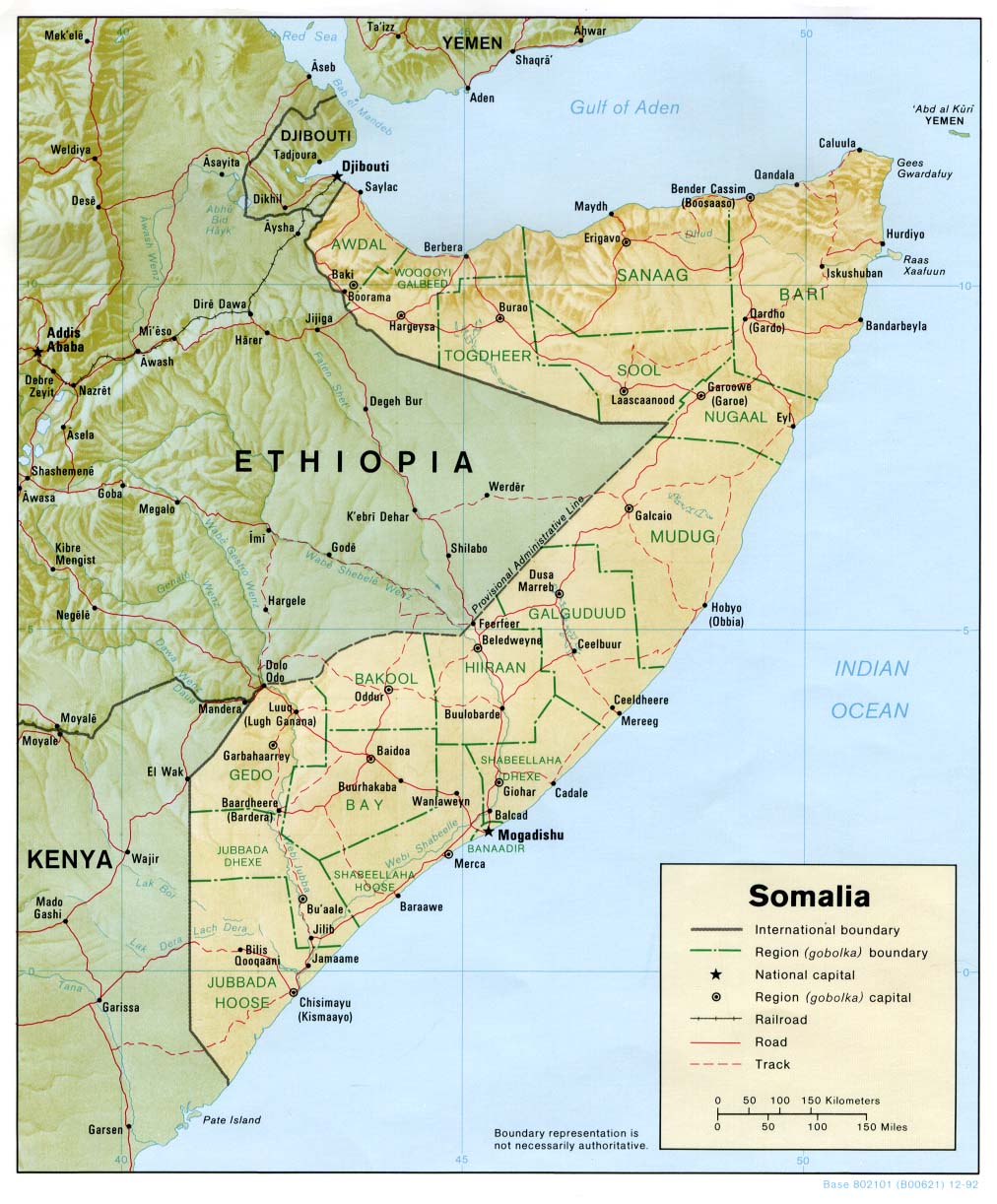
Pimtara
| Pimtara | Shaded relief map of Somalia, 1992, produced by the U.S. Central Intelligence Agency. |
| Evla | |
| Klita | University of Texas Libraries, Perry-Castañeda Library Map Collection: Somalia Maps |
| Askisik | CIA |
Sortara :
| Cette image est une œuvre d'un employé de la Central Intelligence Agency, réalisée dans le cadre des tâches officielles de cette personne. En tant qu’œuvre du Gouvernement des États-Unis d'Amérique, ce document est placé dans le domaine public aux États-Unis d'Amérique.
|

|
Iyeltakizvot
Witison va iyeltak inde in banugale awir, va evla/bartiv vulegal !!
| Evla/Bartiv | Aluk | Lumeem | Favesik | Sebuks | |
|---|---|---|---|---|---|
| ref | 24 bareaksat 2010 à 16:35 | | 1012 × 1222 (205 kio) | Martin H. | {{Information |Description= Shaded relief map of Somalia, 1992, produced by the U.S. Central Intelligence Agency. |Source= University of Texas Libraries, Perry-Castañeda Library Map Collection: [http://www.lib.utexas.edu/maps/somalia.html Somalia Maps] { |
Favera va iyeltak
Valevefa bugluyaxa va bat iyeltak :