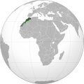
Iyeltak:Morocco (orthographic projection).svg

Le contenu de la page n’est pas pris en charge dans d’autres langues.
Teliz mal Wikipedia.

Xantaf iyeltak(SVG iyeltak, prekson 550 × 550 pixels, iyeltakaldo : 307 kio)

Bat iyeltak tir mal Wikimedia Commons ise gan yonar abdumimaks rotir zo faver. Pimtara moe inafu iyeltakbu valeveon zo nedir.

Sahara marocain

Pimtara

Pimtara
العربية: تحديد المغرب مع إقليمه المتنازع عليه الصحراء المغربية بشكل مخطط، الأمم المتحدة تعترف بصحراء المغرب.
Español: Localización de Marruecos y del territorio ocupado del Sahara Occidental. Ni las Naciones Unidas ni nungún país del mundo reconoce a Marruecos la soberanía sobre dicho territorio, que a ojos de la Comunidad Internacional sigue siendo considerado un Territorio No Autónomo pendiente de descolonización como así lo corrobora el informe S/2002/161.
Français : Localisation du Maroc et de son territoire contesté Sahara occidental, en pointillés. Les Nations Unies reconnaissent au Maroc la souveraineté administrative sur ce territoire.
Deutsch: Lokalisierung Marokkos und seines strittigen Territoriums Westsahara, gestrichelt dargestellt. Die Vereinten Nationen gestehen Marokko Verwaltungshoheit über das Territorium zu.
English: Locator of Morocco and the disputed territory Western Sahara shown as striped. United Nations recognize Morocco as an administrative power of the territory.
Português: Localização de Marrocos e do seu território contestado Saara Ocidental, tracejado. As Nações Unidas concedem a Marrocos a soberania administrativa sobre esse território.
Evla
Klita

Pilkaf grabom


বাংলা  English  español  français  italiano  日本語  македонски  sicilianu  中文(简体)  中文(繁體)  +/−

GNU head Permission is granted to copy, distribute and/or modify this document under the terms of the GNU Free Documentation License, Version 1.2 or any later version published by the Free Software Foundation; with no Invariant Sections, no Front-Cover Texts, and no Back-Cover Texts. A copy of the license is included in the section entitled GNU Free Documentation License.
  • «The Secretary-General shared the view of his Personal Envoy that further meetings of the parties would not succeed, and could indeed be counterproductive, unless the Government of Morocco, as administrative power of the Territory, was prepared to offer or support some devolution of authority», United Nations General Assembly A/56/159, 9 July 2001 (Archived)
Askisik Flad
Autres versions

والمغرب في صحرائه وصحراء في مغربها

Sortara :

GNU head Permission is granted to copy, distribute and/or modify this document under the terms of the GNU Free Documentation License, Version 1.2 or any later version published by the Free Software Foundation; with no Invariant Sections, no Front-Cover Texts, and no Back-Cover Texts. A copy of the license is included in the section entitled GNU Free Documentation License.
w:fr:Creative Commons
gaara Milinde paká
Bat iyeltak wetce Creative Commons Attribution-Share Alike 3.0 Unported zo sortayar.
Til nuyaf :
  • Ta walzilira – ta ksudara va kobara azu walzilira azu deara
  • Ta warzafa ponara – Ta zalera va grabom
Nope valevef kredeem :
  • gaara – Va folack govanzilil ise va gluyaxa godaful ise gobazel kase betara al zo skud. Laninde gonaskil voxe mekane gometiavel da gelfasik va rin ik rinafa favera vanovar.
  • Milinde paká – Ede va bat valdig betal ike artazukar ike voner, pune va nekis valdig wetce mila ok milafa sorta gu bat goxolel.
Ce bandeau de licence a été ajouté à ce fichier dans le cadre de la procédure de mise à jour des licences des images sous GFDL.

Légendes

Ajoutez en une ligne la description de ce que représente ce fichier
Morocco WS-included (orthographic projection).svg

Éléments décrits dans ce fichier

dépeint français

créé par français

Valeur sans élément de Wikidata

taneaksat 2010

Iyeltakizvot

Witison va iyeltak inde in banugale awir, va evla/bartiv vulegal !!

(ironokaf | tel losavsaf) Va (lowarzaf 10 | ) ik (10 | 20 | 50 | 100 | 250 | 500) disukel.
Evla/BartivAlukLumeemFavesikSebuks
ref13 anyusteaksat 2011 à 04:40Aluk va siatos ke 13 anyusteaksat 2011 à 04:40550 × 550 (307 kio)Banhtrung1Added the South Sudan.
9 alubeaksat 2011 à 19:30Aluk va siatos ke 9 alubeaksat 2011 à 19:30550 × 550 (292 kio)Omar-Toonsplease read the description + consensus that this is the right version to be shared under this name
9 alubeaksat 2011 à 19:28Aluk va siatos ke 9 alubeaksat 2011 à 19:28550 × 550 (293 kio)EddoUser talk:Omar-Toons
9 alubeaksat 2011 à 16:22Aluk va siatos ke 9 alubeaksat 2011 à 16:22550 × 550 (292 kio)Omar-ToonsReverted to version as of 13:04, 8 May 2011 please read the description
9 alubeaksat 2011 à 06:25Aluk va siatos ke 9 alubeaksat 2011 à 06:25550 × 550 (293 kio)EddoReverted to version as of 07:11, 8 May 2011
8 alubeaksat 2011 à 13:04Aluk va siatos ke 8 alubeaksat 2011 à 13:04550 × 550 (292 kio)RekafReverted to version as of 00:02, 6 July 2010 -- the original file is already striped, you can upload a new version with light-green
8 alubeaksat 2011 à 07:11Aluk va siatos ke 8 alubeaksat 2011 à 07:11550 × 550 (293 kio)EddoWest Sahara is not part of Morocco
6 alubeaksat 2011 à 08:15Aluk va siatos ke 6 alubeaksat 2011 à 08:15550 × 550 (292 kio)Omar-ToonsReverted to version as of 16:33, 3 May 2011 Another version (WS excluded) exists. Reverting non-consensual change
3 alubeaksat 2011 à 18:01Aluk va siatos ke 3 alubeaksat 2011 à 18:01550 × 550 (293 kio)EddoRedrawing the border between Morocco and West Sahara, please don't erase it
3 alubeaksat 2011 à 16:33Aluk va siatos ke 3 alubeaksat 2011 à 16:33550 × 550 (292 kio)FladReverted to version as of 00:02, 6 July 2010
(ironokaf | tel losavsaf) Va (lowarzaf 10 | ) ik (10 | 20 | 50 | 100 | 250 | 500) disukel.

Meku bu va bata ewava ruldar.

Jadifa iyeltakura

Veyorigeem