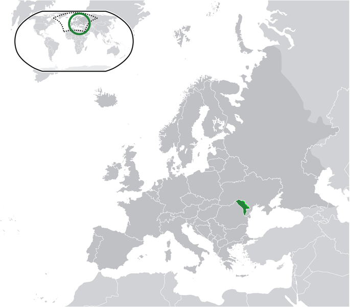
Iyeltak:Location Moldova Europe.png

Lum ke bata abdiwira : 685 × 600 px. Ar goraks: 274 × 240 px | 548 × 480 px | 877 × 768 px | 1170 × 1024 px | 2056 × 1800 px.
Xantaf iyeltak (2056 × 1800 pixel, iyeltakaldo : 422 kio, MIME ord : image/png)
Iyeltakizvot
Witison va iyeltak inde in banugale awir, va evla/bartiv vulegal !!
| Evla/Bartiv | Aluk | Lumeem | Favesik | Sebuks | |
|---|---|---|---|---|---|
| ref | 22 alubeaksat 2021 à 09:58 |  | 2056 × 1800 (422 kio) | Lupishor | Reverted to version as of 23:13, 11 July 2020 (UTC) Map is wrong, showing a part of Ukraine as part of Moldova |
| 19 alubeaksat 2021 à 18:10 |  | 2056 × 1800 (327 kio) | Yesua Rafael Jara Alcivar | Reverted to version as of 01:27, 19 May 2021 (UTC) | |
| 19 alubeaksat 2021 à 01:27 |  | 2056 × 1800 (426 kio) | Yesua Rafael Jara Alcivar | Reverted to version as of 01:20, 19 May 2021 (UTC) | |
| 19 alubeaksat 2021 à 01:27 |  | 2056 × 1800 (327 kio) | Yesua Rafael Jara Alcivar | Agregando sus verdaderos territorios | |
| 19 alubeaksat 2021 à 01:20 |  | 2056 × 1800 (426 kio) | Yesua Rafael Jara Alcivar | Añadiendo territorios que le pertenecen | |
| 11 pereaksat 2020 à 23:13 |  | 2056 × 1800 (422 kio) | De728631 | added South Sudan to World map | |
| 22 toleaksat 2010 à 15:57 |  | 2056 × 1800 (355 kio) | Dinamik | colors | |
| 17 teveaksat 2009 à 23:34 |  | 2056 × 1800 (365 kio) | Bosonic dressing | {{Information |Description={{en|1=Moldova (green) / Transnistria (light green) / Europe (all green & dark grey); inspired by and consistent with general country locator maps by User:Vardion, et al}} |Source=Own work by uploader |Author=[[User:Bosonic dres |
Favera va iyeltak
Valevefa 3 bugluyaxa va bat iyeltak :
Jadifa iyeltakura
Valevefi wiki va bat iyeltak malsaved :
- Favera dene af.wikipedia.org
- Favera dene af.wiktionary.org
- Favera dene ami.wikipedia.org
- Favera dene an.wikipedia.org
- Favera dene ar.wikipedia.org
- Favera dene ary.wikipedia.org
- Favera dene arz.wikipedia.org
- Favera dene ast.wikipedia.org
- Favera dene awa.wikipedia.org
- Favera dene azb.wikipedia.org
- Favera dene az.wikipedia.org
- Favera dene az.wiktionary.org
- Favera dene ban.wikipedia.org
- Favera dene ba.wikipedia.org
- Favera dene be-tarask.wikipedia.org
- Favera dene be.wikipedia.org
- Favera dene bh.wikipedia.org
- Favera dene bi.wikipedia.org
- Favera dene bn.wikipedia.org
- Favera dene bo.wikipedia.org
- Favera dene bs.wikipedia.org
- Favera dene bxr.wikipedia.org
- Favera dene ca.wikipedia.org
- Favera dene cbk-zam.wikipedia.org
- Favera dene ce.wikipedia.org
- Favera dene chr.wikipedia.org
- Favera dene ckb.wikipedia.org
- Favera dene csb.wikipedia.org
- Favera dene cs.wikipedia.org
- Favera dene cv.wikipedia.org
- Favera dene cy.wikipedia.org
- Favera dene de.wikipedia.org
- Favera dene diq.wikipedia.org
- Favera dene dty.wikipedia.org
- Favera dene dv.wikipedia.org
- Favera dene el.wikipedia.org
- Favera dene el.wikivoyage.org
- Favera dene en.wikipedia.org
loa favera va bat iyeltak wil !!

