
Iyeltak:LocationIndianOcean.png
Lum ke bata abdiwira : 800 × 405 px. Ar goraks: 320 × 162 px | 640 × 324 px | 1024 × 519 px | 1280 × 648 px | 2760 × 1398 px.
Xantaf iyeltak (2760 × 1398 pixel, iyeltakaldo : 91 kio, MIME ord : image/png)
Pimtara
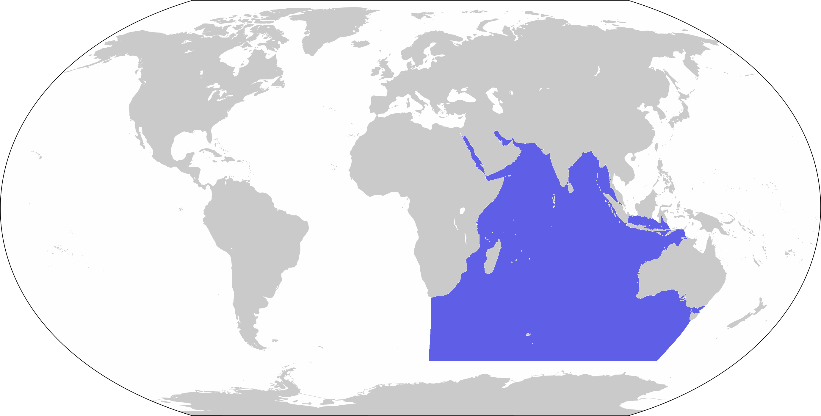
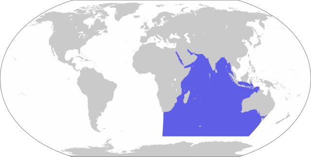
| Pimtara | World map depicting Indian Ocean; map adapted from PDF World map at CIA World Fact Book |
| Evla | |
| Klita | 800px-LocationBlank.png |
| Askisik | user:Xfigpower |
Sortara :
Cette image est dans le domaine public parce que son contenu provient du World Factbook, édité par la Central Intelligence Agency des États-Unis d’Amérique.
|
 |
Iyeltakizvot
Witison va iyeltak inde in banugale awir, va evla/bartiv vulegal !!
| Evla/Bartiv | Aluk | Lumeem | Favesik | Sebuks | |
|---|---|---|---|---|---|
| ref | 27 bareaksat 2019 à 10:39 | | 2760 × 1398 (91 kio) | Lasunncty | Higher resolution and more accurate boundaries |
| 30 santaneaksat 2006 à 13:56 |  | 800 × 407 (72 kio) | Xfigpower | {{Information |Description=World map depicting Indian Ocean; map adapted from PDF World map at CIA World Fact Book |Source=800px-LocationBlank.png |Date=2006-11-30 |Author=user:Xfigpower |Permission |
Favera va iyeltak
Valevefa bugluyaxa va bat iyeltak :
Jadifa iyeltakura
Valevefi wiki va bat iyeltak malsaved :
- Favera dene an.wikipedia.org
- Favera dene ar.wikipedia.org
- جزر القمر
- مضيق هرمز
- الخليج العربي
- سريلانكا
- المحيط الهندي
- زلزال وتسونامي المحيط الهندي 2004
- المحيط الهادئ
- قناة السويس
- تصنيف:جزر القمر
- نياس
- المالديف
- سيشل
- مدغشقر
- موريشيوس
- بنط
- شبه الجزيرة العربية
- تصنيف:موريشيوس
- بحر العرب
- باس (مضيق)
- البحر الأحمر
- برنيس
- سفاجا
- ماليه
- باب المندب
- خليج العقبة
- خليج السويس
- بوبيان
- جسر الملك فهد
- فيلكا
- اللؤلؤة قطر
- مومباسا
- مايوت
- تيران (مضيق)
- معركة ديو
- بالي
- الحلانيات (جزر)
- زلزال سومطرة 2005
- تصنيف:مدغشقر
- مقديشو
- جاوة
- بورتسودان
- حادث عبارة السلام 98
- المحيط المتجمد الشمالي
- خليج عدن
- القرن الإفريقي
- سترة (البحرين)
- سومطرة
- المحيط الجنوبي
loa favera va bat iyeltak wil !!