
Iyeltak:Iran (orthographic projection).svg

Taille de cet aperçu PNG pour ce fichier SVG : 553 × 553 px. Ar goraks: 240 × 240 px | 480 × 480 px | 768 × 768 px | 1024 × 1024 px | 2048 × 2048 px.
Xantaf iyeltak (SVG iyeltak, prekson 553 × 553 pixels, iyeltakaldo : 291 kio)
ععخه
Pimtara
| Pimtara |
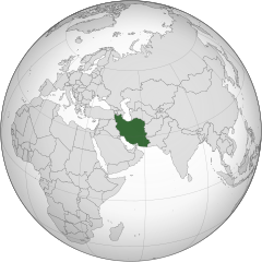
English: Iran
فارسی: ایران |
||||
| Evla | |||||
| Klita |
Pilkaf grabom (Texte original : Own work,)
|
||||
| Askisik | P30Carl | ||||
| Autres versions |
.svg)
|
||||
| SVG information |
.svg)
.svg)
.svg)
.svg)
.svg)
.svg)
.svg)
.svg)
.svg)
.svg)
.svg)
.svg)
.svg)
.svg)
.svg)
.svg)
.svg)
.svg)
.svg)
.svg)
.svg)
.svg)
.svg)
.svg)
.svg)
.svg)
.svg)
.svg)
.svg)
.svg)
.svg)
.svg)
.svg)
.svg)
.svg)
.svg)
.svg)
.svg)
.svg)
.svg)
.svg)
.svg)
.svg)
.svg)
.svg)
.svg)
.svg)
.svg)
.svg)
.svg)
.svg)
.svg)
.svg)
.svg)
.svg)
.svg)
.svg)
.svg)
.svg)
.svg)
.svg)
.svg)
.svg)
.svg)
.svg)
.svg)
.svg)
.svg)
.svg)
.svg)
.svg)
.svg)
.svg)

.svg)

.svg)

.svg)
.svg)
.svg)
.svg)
.svg)
.svg)
.svg)


.svg)
.svg)
.svg)
.svg)
.svg)
.svg)
.svg)

.svg)
.svg)
.svg)
.svg)
.svg)
.svg)
.svg)
.svg)
.svg)

.svg)
.svg)
.svg)
.svg)
.svg)
.svg)
.svg)
_without_national_boundaries.svg)
.svg)
.svg)
.svg)
.svg)
.svg)
.svg)

.svg)
.svg)
.png)
.svg)
.svg)
.svg)
.svg)

.svg)
.svg)
.svg)
.svg)
.svg)
.svg)
.svg)
.svg)
.svg)
.svg)
.svg)

.svg)
.svg)
.svg)
.svg)
.svg)
.svg)
.svg)
.svg)
.svg)

.svg)
.svg)

.svg)
.svg)
.svg)
.svg)
.svg)
.svg)
.svg)
.svg)
.svg)
.svg)
.svg)
.svg)
.svg)
.svg)
.svg)
.svg)
.svg)
.svg)
.svg)
.svg)
.svg)
.svg)
.svg)
.svg)
.svg)
.svg)
.svg)
_-_Crimea_disputed.svg)
.svg)
.svg)
.svg)
.svg)
.svg)
.svg)
.svg)
.svg)
.svg)
.svg)
.svg)
_political.svg)
.svg)
.svg)
.svg)
.svg)
_-_Crimea_disputed_-_no_borders.svg)
.svg)
.svg)
.svg)
.svg)
.svg)
.svg)
.svg)
.svg)
.svg)
.svg)
.svg)

.svg)
.svg)
.svg)

.png)
.svg)
.svg)
.svg)
.svg)
.svg)
.svg)
.svg)
.svg)
.svg)
.svg)
.svg)
.svg)
.svg)
.svg)
.svg)
.svg)
.svg)
.svg)
.svg)
.svg)
.svg)
.svg)
.svg)
.svg)
.svg)
.svg)
.svg)
.svg)
.svg)
.svg)
.svg)
.svg)
.svg)
.svg)
.png)
.svg)
.svg)
.svg)
_(orthographic_projection).png)
.svg)
.svg)
.svg)
Sortara :
Moi, en tant que détenteur des droits d’auteur sur cette œuvre, je la publie sous les licences suivantes :
Bat iyeltak wetce Creative Commons Attribution-Share Alike 3.0 Unported zo sortayar.
- Til nuyaf :
- Ta walzilira – ta ksudara va kobara azu walzilira azu deara
- Ta warzafa ponara – Ta zalera va grabom
- Nope valevef kredeem :
- gaara – Va folack govanzilil ise va gluyaxa godaful ise gobazel kase betara al zo skud. Laninde gonaskil voxe mekane gometiavel da gelfasik va rin ik rinafa favera vanovar.
- Milinde paká – Ede va bat valdig betal ike artazukar ike voner, pune va nekis valdig wetce mila ok milafa sorta gu bat goxolel.

|
Permission is granted to copy, distribute and/or modify this document under the terms of the GNU Free Documentation License, Version 1.2 or any later version published by the Free Software Foundation; with no Invariant Sections, no Front-Cover Texts, and no Back-Cover Texts. A copy of the license is included in the section entitled GNU Free Documentation License. |
Va solnarina sorta rorewal
| Annotations | Cette image est annotée : Voir les annotations sur Wikimedia Commons |
Iyeltakizvot
Witison va iyeltak inde in banugale awir, va evla/bartiv vulegal !!
| Evla/Bartiv | Aluk | Lumeem | Favesik | Sebuks | |
|---|---|---|---|---|---|
| ref | 16 bareaksat 2015 à 23:32 | | 553 × 553 (291 kio) | Flappiefh | Removed Somaliland and Kosovo. Separated Western Sahara and Morroco. |
| 4 anyusteaksat 2013 à 12:27 |  | 553 × 553 (295 kio) | Flappiefh | Added South Sudan. | |
| 30 anyusteaksat 2009 à 08:03 |  | 541 × 541 (749 kio) | P30Carl | {{Information |Description={{en|1=Iran}} {{fa|1=ایران}} |Source=Own work, {{Inkscape}}<br />[http://www.aquarius.geomar.de/omc/make_map.html Aquarius.geomar.de]<br />{{GFDL-GMT|migration=redundant}} |Author=P30Carl |Date=August 2009 |
Favera va iyeltak
Valevefa bugluyaxa va bat iyeltak :
Jadifa iyeltakura
Valevefi wiki va bat iyeltak malsaved :
- Favera dene ady.wikipedia.org
- Favera dene af.wikipedia.org
- Favera dene ami.wikipedia.org
- Favera dene arc.wikipedia.org
- Favera dene ar.wikipedia.org
- إيران
- الدولة البهلوية
- ملوك فارس وإيران
- توقيت إيران
- قائمة الدول ذات السيادة والأقاليم التابعة في آسيا
- الحكومة الإيرانية المؤقتة
- قرار مجلس الأمن التابع للأمم المتحدة رقم 1696
- مستخدم:Alhassan Ehab/ملعب
- مستخدم:جار الله/قائمة صور مقالات العلاقات الثنائية
- العلاقات الأنغولية الإيرانية
- العلاقات الإيرانية الكورية الجنوبية
- العلاقات الإريترية الإيرانية
- العلاقات الإيرانية السويسرية
- العلاقات الإيرانية الليختنشتانية
- العلاقات الإيرانية البوليفية
- العلاقات الإيرانية الموزمبيقية
- العلاقات الألبانية الإيرانية
- العلاقات الإيرانية البلجيكية
- العلاقات الإثيوبية الإيرانية
- العلاقات الإيرانية البيلاروسية
- العلاقات الإيرانية الطاجيكية
- العلاقات الإيرانية الرومانية
- العلاقات الأرجنتينية الإيرانية
- العلاقات الإيرانية الغامبية
- العلاقات الإيرانية القبرصية
- العلاقات الإيرانية السيراليونية
- العلاقات الإيرانية النيبالية
- العلاقات الإيرانية الليبيرية
- العلاقات التشيكية الإيرانية
- العلاقات الإيرانية الميانمارية
- العلاقات الإيرانية الكندية
- العلاقات الإيرانية الزيمبابوية
- العلاقات الإيرانية البالاوية
- العلاقات الإيرانية المالية
- العلاقات الإيرانية النيجيرية
- العلاقات الإيرانية الفانواتية
- العلاقات الغابونية الإيرانية
- العلاقات الإيرانية البنمية
- العلاقات الإيرانية الكوبية
- العلاقات الإيرانية الجورجية
- العلاقات الإيرانية التونسية
- العلاقات الإيرانية الكورية الشمالية
- العلاقات الهندية الإيرانية
- العلاقات اليابانية الإيرانية
- العلاقات الإيرانية الإيطالية
- العلاقات الإيرانية الناوروية
loa favera va bat iyeltak wil !!
.svg)
.svg)