
Iyeltak:Comoros (orthographic projection).svg

Taille de cet aperçu PNG pour ce fichier SVG : 550 × 550 px. Ar goraks: 240 × 240 px | 480 × 480 px | 768 × 768 px | 1024 × 1024 px | 2048 × 2048 px.
Xantaf iyeltak (SVG iyeltak, prekson 550 × 550 pixels, iyeltakaldo : 185 kio)
Pimtara
| Pimtara |
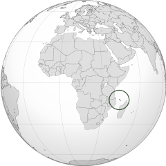
English: Orthographic map of the Comoros |
| Evla | |
| Klita | Pilkaf grabom |
| Askisik | Spesh531 |
| Autres versions |
Derivative works of this file: Africa (orthographic projection).svg .svg) |
.svg)
.svg)
.svg)
.svg)
.svg)
.svg)
.svg)
.svg)
.svg)
.svg)
.svg)
.svg)
.svg)
.svg)
.svg)
.svg)
.svg)
.svg)
.svg)
.svg)
.svg)
.svg)
.svg)
.svg)
.svg)
.svg)
.svg)
.svg)
.svg)
.svg)
.svg)
.svg)
.svg)
.svg)
.svg)
.svg)
.svg)
.svg)
.svg)
.svg)
.svg)
.svg)
.svg)
.svg)
.svg)
.svg)
.svg)
.svg)
.svg)
.svg)
.svg)
.svg)
.svg)
.svg)
.svg)
.svg)
.svg)
.svg)
.svg)
.svg)
.svg)
.svg)
.svg)
.svg)
.svg)
.svg)
.svg)
.svg)
.svg)
.svg)
.svg)
.svg)
.svg)

.svg)

.svg)

.svg)
.svg)
.svg)
.svg)
.svg)
.svg)
.svg)


.svg)
.svg)
.svg)
.svg)
.svg)
.svg)
.svg)

.svg)
.svg)
.svg)
.svg)
.svg)
.svg)
.svg)
.svg)
.svg)

.svg)
.svg)
.svg)
.svg)
.svg)
.svg)
.svg)
_without_national_boundaries.svg)
.svg)
.svg)
.svg)
.svg)
.svg)
.svg)

.svg)
.svg)
.png)
.svg)
.svg)
.svg)
.svg)

.svg)
.svg)
.svg)
.svg)
.svg)
.svg)
.svg)
.svg)
.svg)
.svg)
.svg)

.svg)
.svg)
.svg)
.svg)
.svg)
.svg)
.svg)
.svg)
.svg)

.svg)
.svg)

.svg)
.svg)
.svg)
.svg)
.svg)
.svg)
.svg)
.svg)
.svg)
.svg)
.svg)
.svg)
.svg)
.svg)
.svg)
.svg)
.svg)
.svg)
.svg)
.svg)
.svg)
.svg)
.svg)
.svg)
.svg)
.svg)
.svg)
_-_Crimea_disputed.svg)
.svg)
.svg)
.svg)
.svg)
.svg)
.svg)
.svg)
.svg)
.svg)
.svg)
.svg)
_political.svg)
.svg)
.svg)
.svg)
.svg)
_-_Crimea_disputed_-_no_borders.svg)
.svg)
.svg)
.svg)
.svg)
.svg)
.svg)
.svg)
.svg)
.svg)
.svg)
.svg)

.svg)
.svg)
.svg)

.png)
.svg)
.svg)
.svg)
.svg)
.svg)
.svg)
.svg)
.svg)
.svg)
.svg)
.svg)
.svg)
.svg)
.svg)
.svg)
.svg)
.svg)
.svg)
.svg)
.svg)
.svg)
.svg)
.svg)
.svg)
.svg)
.svg)
.svg)
.svg)
.svg)
.svg)
.svg)
.svg)
.svg)
.svg)
.png)
.svg)
.svg)
.svg)
_(orthographic_projection).png)
.svg)
| Lieu de la prise de vue | | Voir cet endroit et d’autres images sur : OpenStreetMap |
|---|
.svg¶ms=000.000000_N_0015.000000_E_globe:Earth_type:camera_type:satellite_&language=avk)
Sortara :
Moi, en tant que détenteur des droits d’auteur sur cette œuvre, je la publie sous les licences suivantes :
Bat iyeltak wetce Creative Commons Attribution-Share Alike 3.0 Unported zo sortayar.
- Til nuyaf :
- Ta walzilira – ta ksudara va kobara azu walzilira azu deara
- Ta warzafa ponara – Ta zalera va grabom
- Nope valevef kredeem :
- gaara – Va folack govanzilil ise va gluyaxa godaful ise gobazel kase betara al zo skud. Laninde gonaskil voxe mekane gometiavel da gelfasik va rin ik rinafa favera vanovar.
- Milinde paká – Ede va bat valdig betal ike artazukar ike voner, pune va nekis valdig wetce mila ok milafa sorta gu bat goxolel.

|
Permission is granted to copy, distribute and/or modify this document under the terms of the GNU Free Documentation License, Version 1.2 or any later version published by the Free Software Foundation; with no Invariant Sections, no Front-Cover Texts, and no Back-Cover Texts. A copy of the license is included in the section entitled GNU Free Documentation License. |
Va solnarina sorta rorewal
Iyeltakizvot
Witison va iyeltak inde in banugale awir, va evla/bartiv vulegal !!
| Evla/Bartiv | Aluk | Lumeem | Favesik | Sebuks | |
|---|---|---|---|---|---|
| ref | 29 teveaksat 2012 à 16:28 | | 550 × 550 (185 kio) | Spesh531 | == {{int:filedesc}} == {{Information |Description={{en|1=Orthographic map of the Comoros}} |Source={{own}} |Author=Spesh531 |Date=2012-06-29 |Permission= |other_versions={{DerivativeVersions|Africa (orthographic projection).svg}} {{Gr... |
Favera va iyeltak
Valevefa bugluyaxa va bat iyeltak :
Jadifa iyeltakura
Valevefi wiki va bat iyeltak malsaved :
- Favera dene ar.wikipedia.org
- Favera dene arz.wikipedia.org
- Favera dene ast.wikipedia.org
- Favera dene az.wikipedia.org
- Favera dene bg.wikipedia.org
- Favera dene bi.wikipedia.org
- Favera dene ca.wikipedia.org
- Favera dene cdo.wikipedia.org
- Favera dene ce.wikipedia.org
- Favera dene chr.wikipedia.org
- Favera dene cs.wikipedia.org
- Favera dene dag.wikipedia.org
- Favera dene de.wikivoyage.org
- Favera dene diq.wikipedia.org
- Favera dene el.wikipedia.org
- Favera dene en.wikipedia.org
- Favera dene en.wikinews.org
- Favera dene es.wikipedia.org
- Favera dene eu.wikipedia.org
- Favera dene fa.wikivoyage.org
- Favera dene fi.wikivoyage.org
- Favera dene fo.wikipedia.org
- Favera dene fr.wikipedia.org
- Favera dene fr.wikinews.org
- Favera dene ga.wikipedia.org
- Favera dene gcr.wikipedia.org
- Favera dene gl.wikipedia.org
- Favera dene gn.wikipedia.org
- Favera dene hak.wikipedia.org
- Favera dene ha.wikipedia.org
- Favera dene he.wikipedia.org
- Favera dene ht.wikipedia.org
- Favera dene ia.wikipedia.org
- Favera dene id.wikipedia.org
- Favera dene ie.wikipedia.org
- Favera dene incubator.wikimedia.org
loa favera va bat iyeltak wil !!
.svg)
.svg)