
Iyeltak:Cameroon Littoral 300px.png
Me rodadin logijaf lum.
Cameroon_Littoral_300px.png (300 × 404 pixel, iyeltakaldo : 24 kio, MIME ord : image/png)
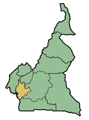
Littoral of Cameroon, map modified from the one on the Provinces of Cameroon article.

|
Permission is granted to copy, distribute and/or modify this document under the terms of the GNU Free Documentation License, Version 1.2 or any later version published by the Free Software Foundation; with no Invariant Sections, no Front-Cover Texts, and no Back-Cover Texts. A copy of the license is included in the section entitled GNU Free Documentation License. |
| Bat iyeltak wetce Creative Commons Attribution-Share Alike 3.0 Unported zo sortayar. | ||
| ||
| Ce bandeau de licence a été ajouté à ce fichier dans le cadre de la procédure de mise à jour des licences des images sous GFDL. |
Credit: Ultratomio, 2005
Info: Map of the provinces of Cameroon with the South Province highlighted. Created with the GIMP.
Iyeltakizvot
Witison va iyeltak inde in banugale awir, va evla/bartiv vulegal !!
| Evla/Bartiv | Aluk | Lumeem | Favesik | Sebuks | |
|---|---|---|---|---|---|
| ref | 25 balemeaksat 2005 à 10:00 | | 300 × 404 (24 kio) | Ultratomio | Littoral of Cameroon, map modified from the one on the Provinces of Cameroon article. {{GFDL}} '''Credit:''' Ultratomio, 2005 '''Info:''' Map of the provinces of Cameroon with the South Province highlighted. Created with the GIMP. |
Favera va iyeltak
Valevefa bugluyaxa va bat iyeltak :
Jadifa iyeltakura
Valevefi wiki va bat iyeltak malsaved :
- Favera dene be.wikipedia.org
- Favera dene bg.wikipedia.org
- Favera dene fr.wikipedia.org
- Favera dene ko.wikipedia.org
- Favera dene lv.wikipedia.org
- Favera dene nl.wikipedia.org
- Favera dene pl.wikipedia.org
- Favera dene ro.wikipedia.org
- Favera dene ru.wikipedia.org
- Favera dene tg.wikipedia.org
- Favera dene tr.wikipedia.org